Category: Features of the Reserves

Articles about the exciting Archaeological features in and around our woodlands

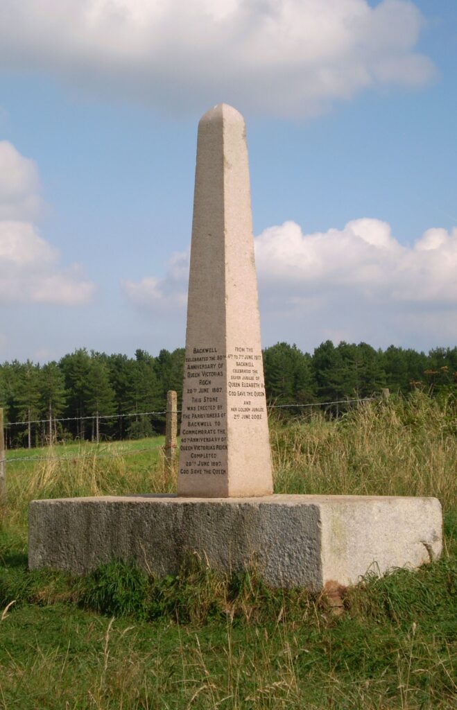
  • The Jubilee Stone

    The Jubilee Stone

    The Jubilee Stone was erected to commemorate the 60th year of Queen Victoria’s reign in 1897. Since then, subsequent royal anniversaries have been added to the obelisk.

    When first installed on the hilltop the surrounding area was open and grazed. After the Second World War neighbouring fields were fenced off for farming and gradually scrub developed and later trees – which became Jubilee Stone Wood.

    The Stone has been a focal point for the village and the venue for many celebrations over the years.

  • Warrener’s Cottage

    Warrener’s Cottage

    Location

    From the Jubilee Stone, take the sign-posted permissive-path heading south for about 50 metres and the remains of the cottage are located on the right hand side. There is an information board next the path.

    History

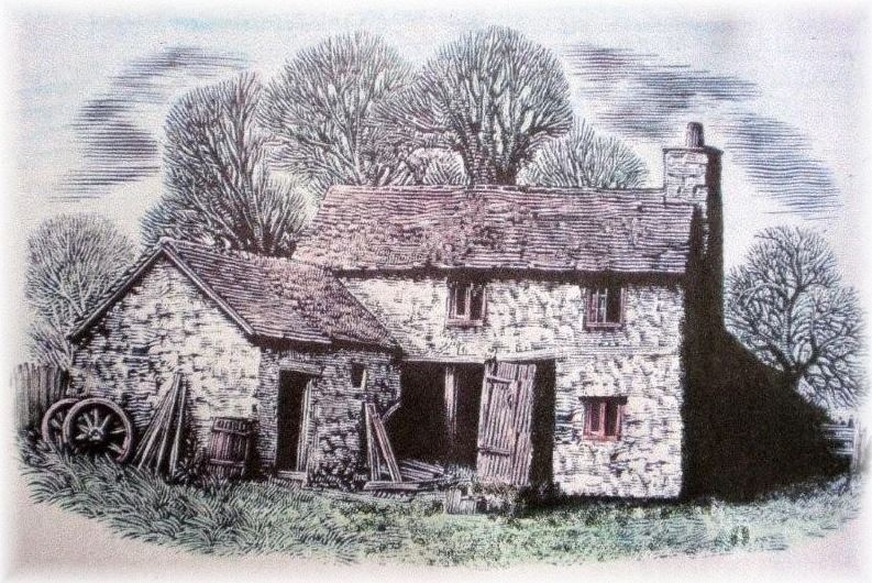
    The largest known dwelling in Jubilee Stone Wood was the cottage and garden referred to on old maps as either ‘Warren House’ or simply ‘The Lodge’. The first written references to the cottage date from the 1780s when the building was repaired after a severe storm. The ruins visible today suggest that the cottage would have originally covered an area of about 40sq metres with the adjacent walled garden (located to the left of the cottage) about 1200sq metres.

    Rabbit Warrens

    Rabbits (or ‘coney’) were introduced into England by the Normans and were highly valued for their meat and fur during the Middle Ages and have remained so almost up to the present day. It is thought rabbits originally came from south-western Europe so to ensure they would thrive in our cooler climate, artificial warrens were built consisting of low, flat topped mounds varying in size from a few metres to over a kilometre in length. These mounds were often referred to as ‘pillow mounds’ and were once quite a common sight in the English countryside.

    Warreners were appointed to protect and harvest the rabbits and it was not unusual for the Lord of the Manor to allocate them suitable accommodation as part of their position. As rabbits were officially classified as ‘game’, no warrens could be established during the period without the express permission of the King.

    The warren in Jubilee Stone Wood was granted to Sir Richard Rodney on the 10th June 1318 by order of King Edward II. References from a survey of the Manor of Backwell in 1709 record that the warren at that time covered an area of 3 furlongs by 1½ furlongs (600 x 300 metres) and would consequently have had the potential to produce many thousands of rabbits per year. The warren appears to have been in continual use until 1812 when the introduction of the Enclosure Act divided the area of the warren into fields which were subsequently allocated to Court Farm. After this date the fields were most likely used for other agricultural purposes and the warren was almost certainly abandoned. 

    The Cottage & Garden

    The warreners who cared for and eventually killed and processed the rabbits were often provided with purpose built accommodation. This was sometimes of a higher standard than was usual for the period and illustrates the importance of rabbits at the time. The cottage would have been a two-storey structure built of shaped limestone blocks extracted from the local bedrock and made watertight with a thatched roof. The warrener would have used the ground floor as a workshop to process the rabbits whilst using the upper storey as his living accommodation. When not working this arrangement would have enabled him to keep a watchful eye out for both predators and poachers approaching the warren. The large adjacent garden would have also allowed the warrener to grow his own produce enabling him to be relatively self-sufficient. After the warren was abandoned, the records show the cottage was still lived in up until 1843, however it too fell derelict some time between 1843 and 1882. 

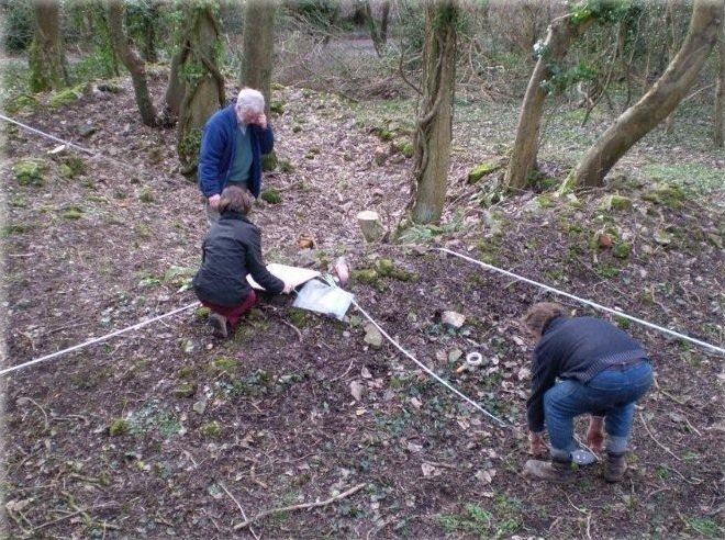
    Surveying the Warrener’s Cottage’s Remains – 2009

    Warreners_Cottage_Survey

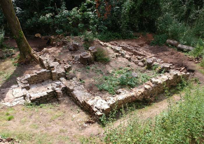
    Cottage Excavation – 2019

    To mark the 700th anniversary of the warren, in 2018 it was decided to expose the remains of the cottage walls.  One year later, the excavations have revealed the structure of the main building plus a porch and two outbuildings. The photo below was taken in July 2019 from a similar viewpoint to the above picture. We had no idea what lay deep under all that soil!

    The story of the excavation and more photos can be followed here:  Warrener’s Cottage Excavation

    Cottage July 2019 700

    The complete story of the Cottage was documented in this article written for the Nailsea and District Local History Society journal, November 2024: Warrener’s Cottage

  • The Lime Kiln

    The Lime Kiln

    Location

    Walk downhill from the Jubilee Stone (towards the Church Town entrance to the reserve) for about 100 metres. The Lime Kiln is situated on your left hand side, about 20 metres along a side path edged with stones & logs.

    Restoration

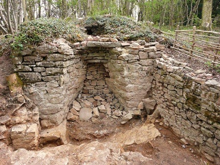
    The restoration of Jubilee Stone Wood’s limekiln began in 2006. By the end of the first year we had removed approximately 1.5 tonnes of rubble to expose more of the structure.


    The kiln itself has been found to be in remarkably good condition – probably protected from the elements by the enormous rubble pile in front of it. The picture below shows the kiln as it was at the end of 2009 (after the removal of approximately 5 tonnes of rubble) when we were at last uncovering the full extent of the structure.

    Limekiln

    Historical Context

    The Lime Kiln in Jubilee Stone Wood was constructed sometime between 1843 and 1884 to convert limestone (calcium carbonate) to ‘quicklime’ or ‘lime’ (calcium oxide). This material had many uses ranging from the production of lime mortar and lime wash for buildings to its use in agriculture as a soil improver. 

    Towards the end of the 19th century, improvements in transport enabled larger industrial kilns to mass-produce lime at comparatively lower prices whilst the use of cement in the construction industry was becoming increasingly popular.

    Historical evidence from old maps indicates that Jubilee Stone Wood’s lime kiln fell into disuse sometime between 1884 and 1902. The adjacent structure probably collapsed soon after the kiln was abandoned which has clearly helped to preserve the kiln in the excellent condition we find it today. 

    The manufacture of quicklime was a time-consuming, dangerous and labour-intensive process. Sufficient limestone and fuel (probably coal and/or wood) would have to be collected and transported, loaded into the kiln and set alight. The limestone was then heated in the kiln at temperatures of up to 1000ºC for around 3 to 4 days. The raw materials needed for the process were all available locally. Wood (or charcoal) could be easily sourced from nearby woodlands and coal could be hauled up Cheston Combe from the pits around Nailsea.

    Limestone was almost certainly mined from the surrounding area and the woodland has several large, square shaped pits where limestone has clearly been extracted.

    Construction

    The kiln has been built from locally extracted, shaped limestone blocks and has been deliberately set into the sloping hillside. This arrangement has the advantages of saving on construction costs whilst also assisting in its ease of operation by being able to load from the top and unload from the bottom. It also ensured the kiln was aligned with the prevailing south-westerly winds which would have helped fan the fire and speed up the conversion process.

    The internal bowl of the kiln would undoubtedly have been lined with Pennant sandstone extracted from around Nailsea. Whenever kilns were constructed from limestone blocks it was always necessary to physically separate the limestone used in the main body of the kiln with the fuel otherwise it too would be converted to quicklime during the lengthy firing process.

    Direcly in front of the kiln are the remains of an open-sided rectangular enclosure which may have served as a storage area for the kiln’s labourers or alternatively used as a sheltered loading point for the extracted quicklime.


  • Limestone Pavement

    Limestone Pavement

    Amazing geological discovery! BET unearths a rare limestone pavement rock formation in Badgers Wood.

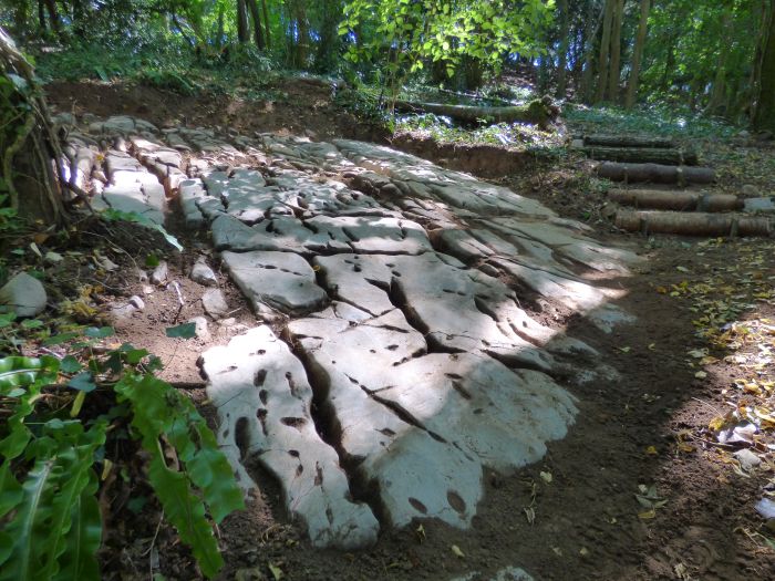
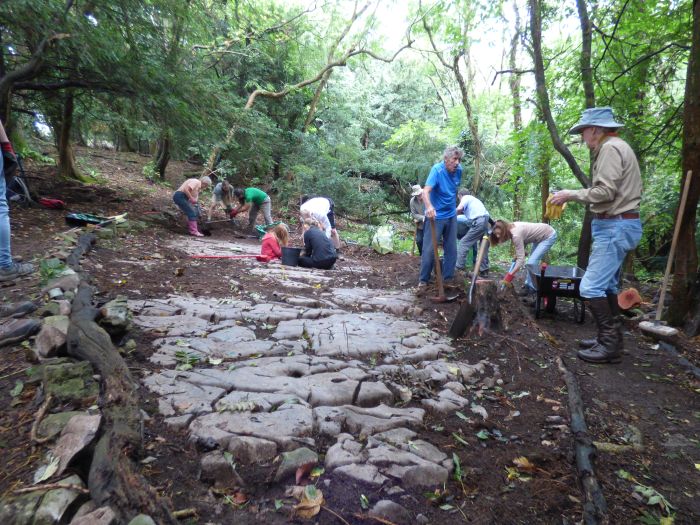
    Whilst reinstating a stretch of little-used public footpath in Badgers Wood in July 2018, volunteers uncovered an unusual limestone rock formation.  Further digging and research showed this to be a “limestone pavement” with its characteristic crevices and gulleys.  A section 5m x 5m was exposed which looks quite dramatic.

    Limestone Pavement 1 700

    Our focus then moved to another stretch, near the top junction of the Fern Way and the Geology Trail, which showed signs of a similar rock formation.

    Limestone Pavement 2 700

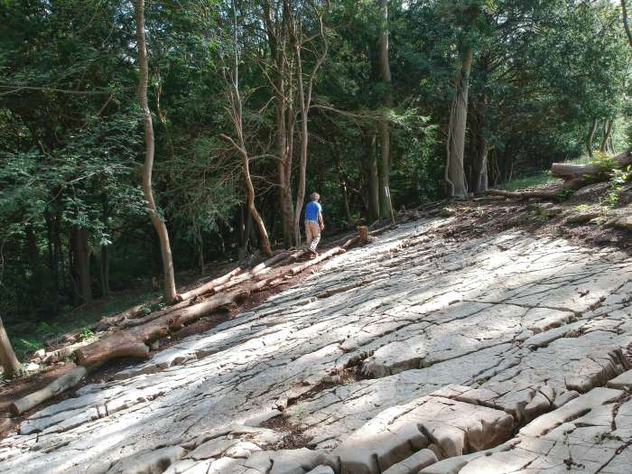
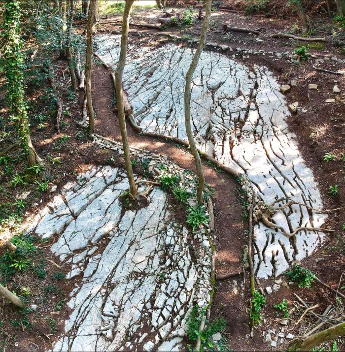
    After a lot of hard work, a large area of limestone pavement has been exposed which is a remarkable feature to visit.

    DJI 4151 HDR 700

     The local RIGS geologist group is really excited by the discovery of this rare limestone pavement and we hope this will lead to further investigation and possibly SSSI status.

    Pavement aerial 700

    What is a limestone pavement?

    A limestone pavement is a flat expanse of exposed limestone formed by a combination of chemical weathering and erosion. Most limestone pavements in the UK are formed on Carboniferous limestone and whilst there are superb examples in Yorkshire, they are an extremely rare geological feature in the south of England.

    How do limestone pavements form?

    1. During the ice ages, much of Britain was covered by ice sheets and glaciers. During this time, the soil and weaker surface rocks were often scoured away, leaving broad expanses of exposed limestone.
    2. With the retreat of the glaciers, moraine material was left behind and a forest eventually established itself. Mildly acidic rain water percolated through the soil which gradually dissolved the limestone surface.
    3. Under the soil, the rain water picked out the joints in the limestone and gradually widened them by dissolving the rock. This created deep fissures called grykes. The blocks of limestone (or clints) were also attacked by the rain and small holes and gulleys (or karren) formed on their surface.
    4. When the ice finally retreated, the soil on the top of the limestone pavement was eroded, washed down into the grykes and removed altogether by the drainage system. The exposed limestone pavement would have been constantly chemically weathered, resulting in the further widening of the grykes and the karren.
    5. Badgers Wood’s extensive limestone pavement is today buried under 5 – 20cms of soil. Sometime in the last thousand years, decomposing vegetation has accumulated on its surface, slowly turning into soil and has consequently buried the once exposed rock surface.

  • Metal Detecting Finds

    Metal Detecting Finds

    This two-page article catalogues the various metal objects discovered in the BET Woods by a local metal detectorist, Keith Matthews, CPO RN, Retired.  Some of the items featured in an article in the BET Bulletin, Spring 2014.  More recent finds have been added to the lists, as they have come to light.  

    These finds give us a fascinating glimpse into the history and lives of the local inhabitants.

    This page presents the various coins that have been found whilst a second page shows other interesting artefacts: Metal Detecting Finds (2)


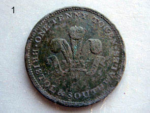
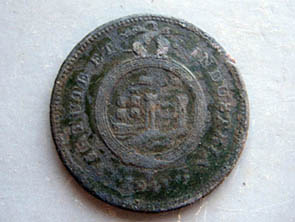
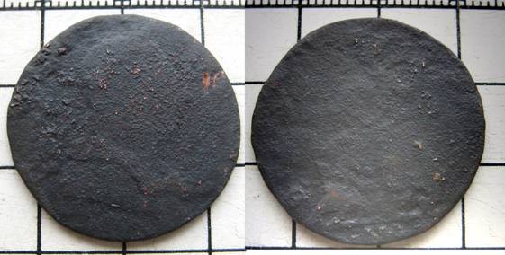
    Bristol & South Wales One Penny Token, dated 1811. Due to a shortage of copper (the Navy was copper bottoming its ships at the time), local associations/ industries produced tokens in place of small change in the early 19th century, like this one for use in specific areas.


    Made by Thomas Halliday of Bristol.


    Die Engraver – Bristol Brass & Copper Co.

    1811 Penny
    1811 Penny rev

    Victorian four pence piece or ‘Britannia Groat’, 1845

    1845 groat 01

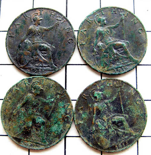
    Four farthings 1909, 1915, 1916, 1917 all found in one hole.  Probably a ‘pocket spill’.

    A George II ha’penny, date unknown.  You can just make out “GIUS” at 10 o’clock and “II” at 1 o’clock.  This is being soaked in olive oil , hopefully to soften the crud.

    George II (1683 – 1760) was  King of Great Britain and Ireland.  He married Caroline of Ansbach in 1705, and was the last British King to fight in battle (in Austrian War of Succession).  He was patron of musicians, including Handel.


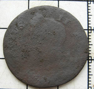
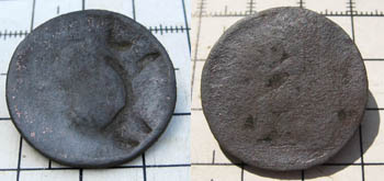
    A George III (1738-1820) ha’penny, in poor condition, with only “GIUS“ (from Georgius) readable. The indistinct bust of himself is facing right, which helps identify it.

    A second battered George III ha’penny is shown underneath.


    George III halfpenny

    Geo III halfpenny 2 copy


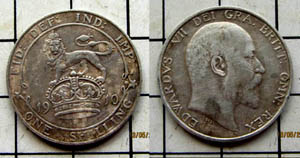
    Edward VII shilling, 1910 – solid silver.

    Edward VII (1841 – 1910) married Alexandra of Denmark in 1863, and later succeeded his mother Queen Victoria as King, upon her death in 1901.

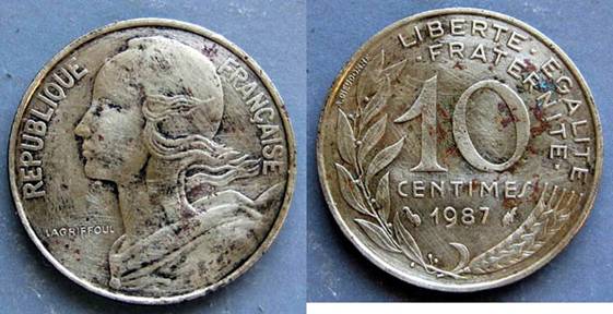
    French 10 centimes of 1987

    10 Centimes

    Click here to see other finds: Metal Detecting Finds (2)


  • Metal Detecting Finds (2)

    Metal Detecting Finds (2)

    This second page catalogues the fascinating collection of non-coin objects discovered in the woods.


    An unusual very large safety pin with traces of gilding.  Possibly a scarf pin.

    Safety Pin

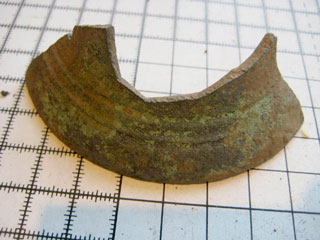
    Section of a bronze bell. Probably post-Medieval and maybe 500/600 years old.

    bronze pot 02

    Part of a cast iron pot or cauldron.  Probably 18th or 19th century.

    Iron Pot Fragment

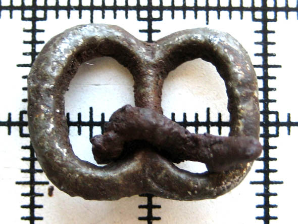
    Buckle from 16th or 17th Century

    Buckle

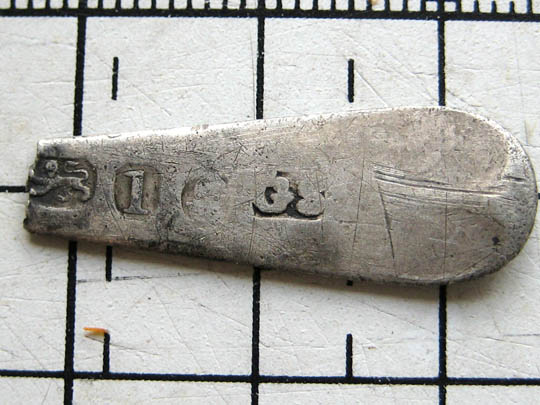
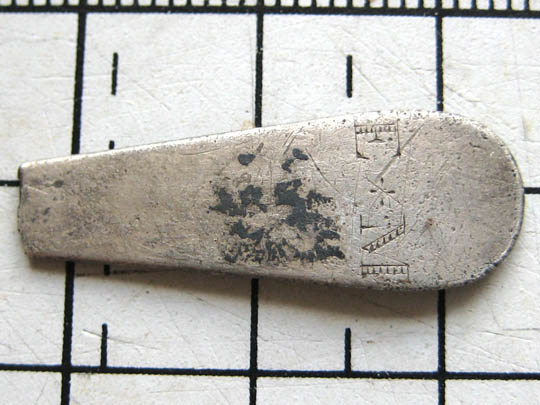
    Silver spoon handle, hallmarked London 1786/7, maker George Smith. The reverse has the initials E M.

    Spoon handle 01

    Spoon handle 02

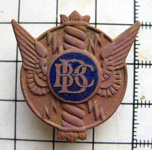
    ​BBC staff lapel badge, worn 1940s – 1960s

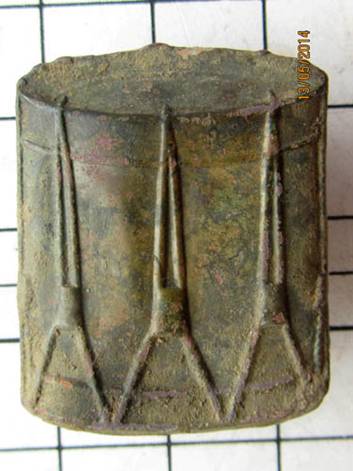
    Drummers badge of unknown type

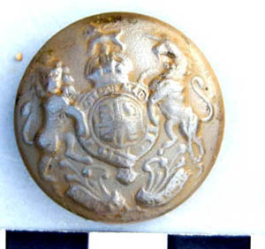
    Army General Service button mid 20th Century.

    Two of these have been found.


    ​Bristol Tramways & Carriage Company Ltd button.

    BTCC became Bristol Omnibus Co in the mid 1950s.

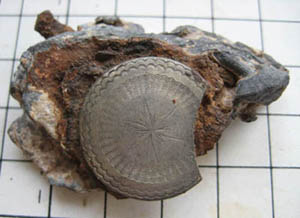
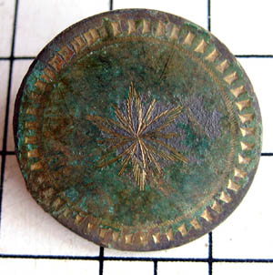
    An 18th Century decorated button firmly embedded in a chunk of lead, with a ferrous material in between.

    18th Century decorated button.

    Evidence of heavy industry!
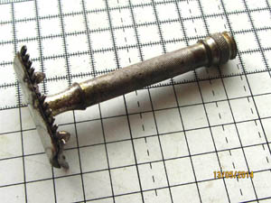
    Razor!
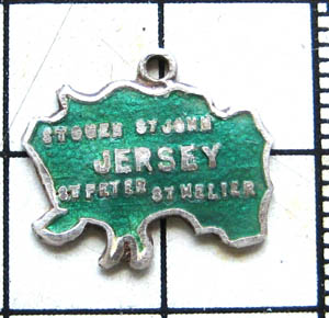
    A souvenir from Jersey!
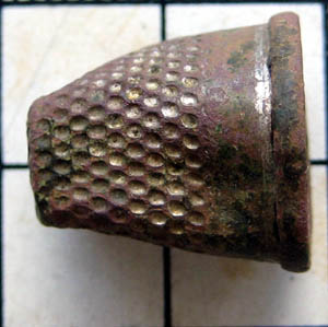
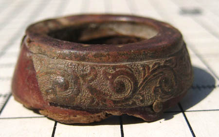
    A child’s thimble – internal diameter approx 10mm.
    As yet unidentifed!  
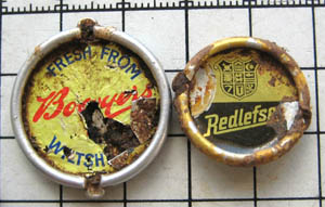
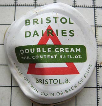
    Pot tops
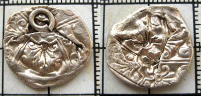
    Possibly a small bell or spherical locket – squashed. Not yet confirmed as silver.
    Squashed
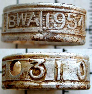
    Bird leg ring confirmed by the British Wildfowl Association as almost certainly off a Barnacle Goose.
    Legring copy

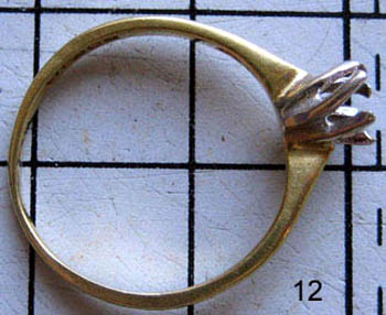
    A gold engagement ring, sans stone, London Assay mark 1977, 19 carat.

    BW Ring  copy

    A time fuse from a WW2 3.7inch AA shell

     
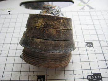
    JSW 3.5in fuse

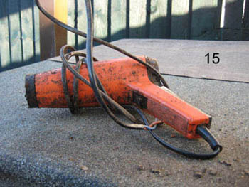
    A hair dryer

     
    BW Hair-Dryer  copy

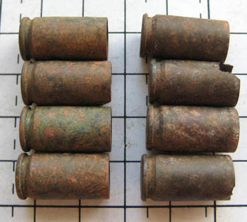
    Almost a full clip of 9mm pistol ammunition

     
    BW 9mm 18 Apr 14 copy

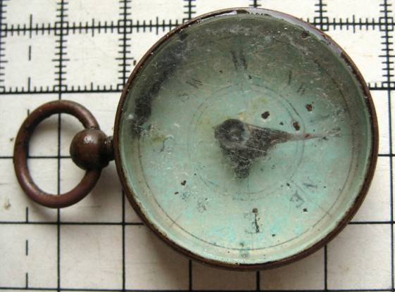
    Compass

     
    Compass

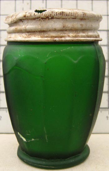
    A cream pot of the Icilma Cosmetic Co. One reference reports their closing down in 1932, whilst another shows them registering trademarks in 1962.

    Apparently, they had definitely closed by 1979. This is probably from 1940s-1950s.

    Cream Pot
     
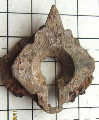
    A keyhole escutcheon plate. The rivets on the back suggest it was attached to a metal container.
    Keyhole BW copy
     

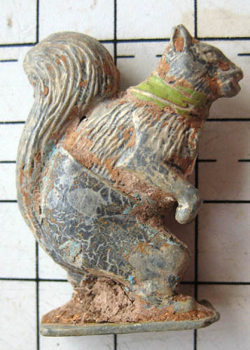
    A Cadbury Britains hollow cast Cococub Nutty Squirrel. Cococubs was a kids club of the 1930s. There were 30+ figures in the range. For further details see:

     http://www.cococubs.com/Cubs_Names/cubs_names.html

    Squirrel Bw 1 copy
     

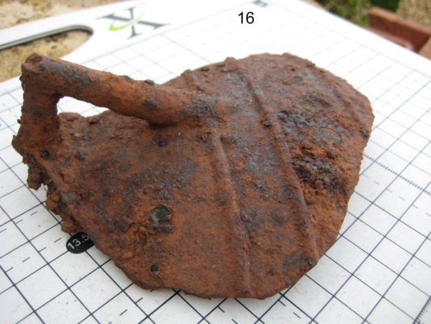
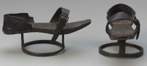
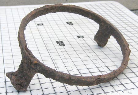
    A “patten”.   Pattens were under-shoes, made from metal or wood and were worn to raise the wearer out of mud or the effluence of city streets. The Worshipful Company of Patten Makers was founded in the 17th Century.  For reference, here is an example of a complete patten:


    Bristol Dairies became part of Cow & Gate around 1968 and later Unigate.
    Shotgun catridges, normally treated by detectorists as scrap. Interestingly, these finds are all different.
    Shotties copy
    An unidentified copper rim from something. The material under the copper appears to be cork.
    Rim
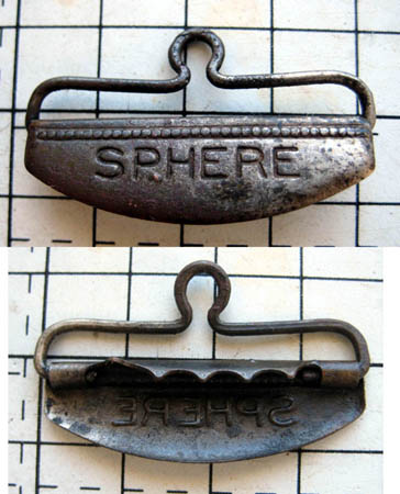
    A clip of some kind.
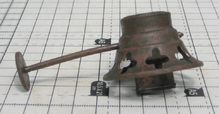
    Oil lamp burner
    Not so old!


  • Ancient Mining

    Ancient Mining

    The evidence of mining in the past is widely spread across both reserves. The most obvious examples are two 17th century underground lead mines located about 150 metres above the Church Town entrance to JSWNR on the right hand side. (There is a information board situated next to the path).

    leadmines The Remains of one of the Lead Mines Today

    The geology of Jubilee Stone Wood is dominated by Carboniferous limestone which was laid down some 300 to 350 million years ago in a warm, shallow sea from the remains of countless marine animals.

    One hundred and fifty million years later during the Jurassic Period, mineral rich water began to be forced up from the hot depths of the earth through the many faults and fissures in the limestone which today has resulted in the accumulation of numerous metal ores in the bedrock.

    Whilst both copper and iron ores are present in the Carboniferous limestone of Backwell Hill, the most abundant minerals are ‘galena’ (lead sulphide) and ‘calamine’ (zinc carbonate). Historical records confirm that both these metals were being mined here during the 17th century and possibly even earlier as was the case at Goblin Combe. Zinc combined with copper is converted into brass which was a highly prized alloy during the period and was much in demand. In fact during this century, most of the calamine extracted from the west of England originated from this area which, in turn, led to the city of Bristol becoming a major centre for the industry.

    Mining Methods

    The mining of lead in the British Isles goes back to prehistoric times and was one of the factors that attracted the Romans to Britain in 43AD. Lead ore or ‘galena’ usually occurs in narrow, vertically orientated seams. When the miners located these outcrops at or near the surface they would have dug simple, open cast circular pits or grooves to extract the ore.

    Some of the deposits of lead however were found to descend deeper into the bedrock and the miners would have ultimately reached a point where it would become too difficult to remove the rock by shovel whilst the steep walls of the pit would have become increasingly unstable. When this situation developed, the miners would have dug vertically down through the limestone bedrock opening up a small shaft where they could more easily follow the linear seam of galena.

    The ore and waste material was removed from the pit by the use of a hand winch (referred to as a ‘jack roller’ or ‘windlass’) attached to a bucket (known as a ‘kibble’). When the miners reached the bottom of the seam or the limits of practical working they would follow the ore seam on the surface and start a new shaft adjacent to the last, repeating the process as far as it was practical to do so.

  • Backwell Cave

    Backwell Cave

     Location

    The cave is just outside the boundary of Badgers Wood on a side path, just before the steps at the lower entrance to Badgers Wood.

    Archaeology

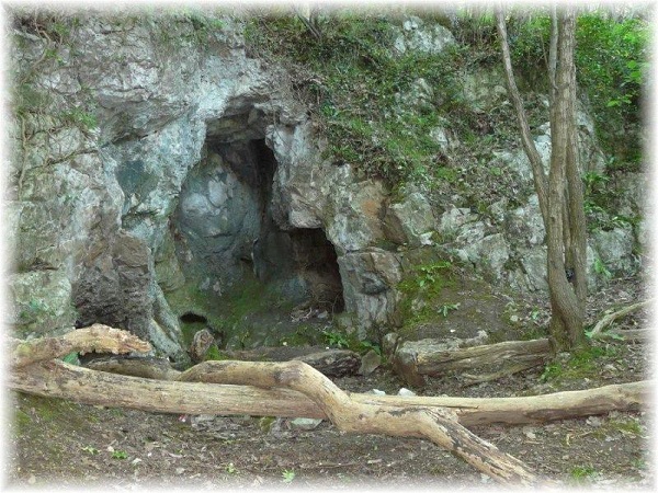
    Backwell Cave is tucked away in the hillside at the bottom end of Cheston Combe, on a small strip of land between BET’s Badgers Wood and the old quarry.  More of a recess than a cave really, it was of great importance to the people who lived nearby over 5,000 years ago.  It was a sacred site, situated where features of the landscape came together – Earth, Sky and the Underworld.  Water also had special properties, whether in streams, rivers, underground pools or, in this case, dripping water down the hillside which would have formed calcite deposits of stalagmites.

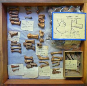
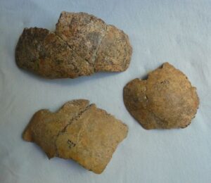
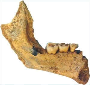
    Backwell Cave was relatively unknown until 1936, when quarry owner Joseph Coles asked two quarrymen to clear out the debris of stones and sticky red clay inside it, over 2.40m (8ft) high, and spreading 3m (4.50ft) down the hillside. When pieces of bone appeared in the soil, digging-out was halted, and in 1937 an excavation was carried out by E. K. Tratman.  Remains of 18-30 individuals – men, women and 3 children were uncovered, their bodies apparently buried on their left sides, in the flexed position.  This could explain why many right side bones were missing, as the bodies were disturbed when further burials were placed over them at a later date.  Even the surviving bones were less than they should be, and only two complete skulls were found, one of which had a large healed fracture, probably by an axe, causing a severe head or brain injury.

    Bones found at the cave during 1937/8

    Animal bones recovered were also fragmentary, with sheep and oxen being the most plentiful, plus badger, not surprising as a sett lay beside the cave itself.  Artefacts included a rare sheep or goat bone double-pointed prong or fork, a leaf-shaped flint arrowhead, a broken flint knife, and 2 spindle whorls for spinning wool.  One, made of liassic limestone was lathe-turned, and the other was of pottery, flat, disc-shaped, and both were possibly Roman.  Amongst the few other pieces was the lip of a wheel-turned black pot, and several early Iron Age fragments. 

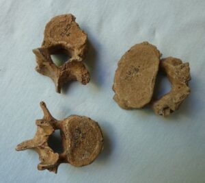
    Unfortunately many of the finds, including the human bones were lost when Bristol Museum was bombed in World War Two, but the good news is that radiocarbon dating has been carried out on 2 of the surviving vertebrae, revealing that they are Neolithic (New Stone Age) and are over 5,000 years old, much earlier than previously thought.  This was a time when people used stone tools, began to build permanent settlements, and took up farming, raising cattle, pigs, a few sheep and growing crops including corn.

    Today it is easier to see where the dead were buried, sometimes in longbarrows or caves, which are still visible, but remains of their settlements and evidence of daily lives are harder to find.  In BET’s Badgers Wood volunteers are opening up parts of the wood by selective tree pruning and clearance of scrubby undergrowth, which may reveal archaeological features to help us understand more about the people who lived there so many years ago.

    Geology

    The cave itself is geologically quite unusual as it was probably formed by hot, mineral-rich water forcing its way out from the hot depths of the earth and not by the more usual water leaching process which is much more common in limestone areas. Its method of formation has resulted in various minerals being deposited on the surface of the cave which, in the right lighting conditions, can shine back as a whole range of bright, steel-blue colours (see photograph below).

    Backwell_Cave


  • Backwell Cave Research Project

    Backwell Cave Research Project

    Adelle 200

    PhD student hopes to shed new light on Backwell Cave burials!

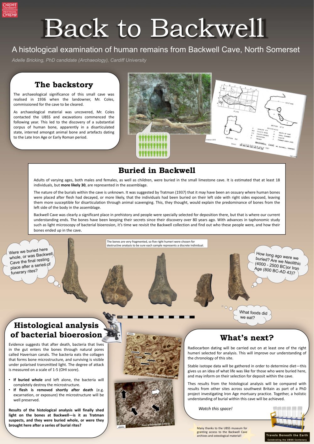
    Cardiff University PhD candidate, Adelle Bricking, is researching Iron Age mortuary practices in southwest England and her studies include bones from Backwell Cave.

    The cave, which is located in the woods very close to BET, was excavated in 1937 and bones from up to 30 individuals were found. The story of the cave can be found here: Backwell Cave

    Using new analysis methods, Adelle hopes the bones can help answer questions about when and how the burials took place and what foods were eaten at that time.

    This research is really exciting and we look forward to hearing about Adelle’s findings and conclusions.

    For further details about the aims of the research and the analysis techniques, click on this link:  Backwell Cave PhD research summary

    Adelle UBSS poster final resize 1000


  • Backwell Barrows

    Backwell Barrows

    Barrow view sm

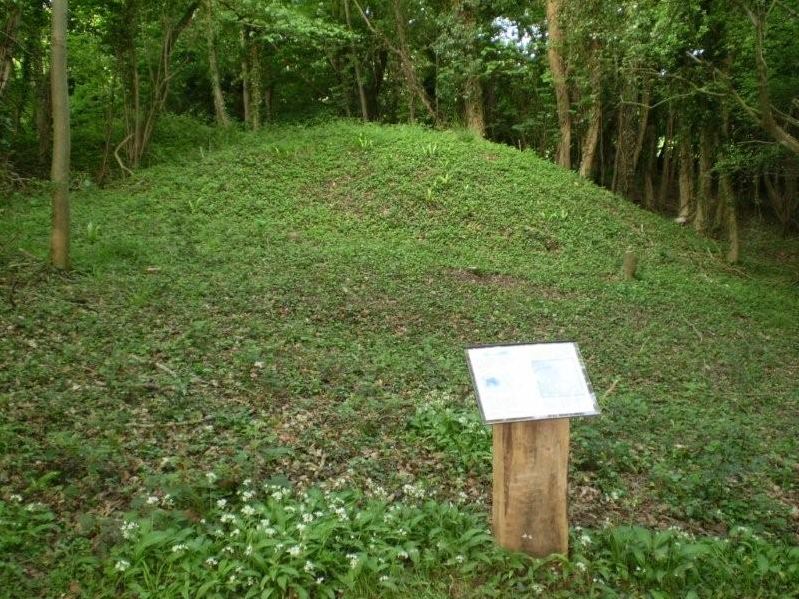
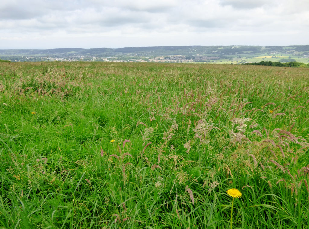
    There is a Bronze Age barrow cemetery in the field by the Jubilee Stone, with 4 – 6 burial mounds dating back 2,500 to 4,000 years, although they are quite hard to make out now. They date from the middle to late Bronze Age, when the usual practice was for the dead to be cremated and buried either individually or as part of a family group. The ashes were then placed, with due ceremony, in specially-made urns, and set upright in a pit in the centre of an earth or rubble mound, sometimes surrounded by a ditch. This is unlike the earlier period when defleshed, disarticulated bones were left in chambered tombs.
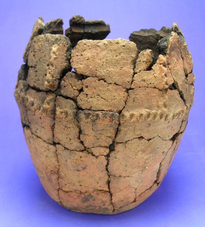
    Urn

    The urn shown here came from a barrow made of stacked-up turfs in a cemetery on the skyline at Beacon Hill, Shepton Mallet. Made of coarse fabric, and decorated with a row of finger prints, it contained the ashes of a female, 18-25 years old.

    Barrows were usually placed on the false crest of a hillside, and in close proximity to the settlement, so the dead were, in theory, still part of the living. No trace has been found of where they lived at Backwell, but it might have been somewhere in BET woods, or down below under more modern houses.

    In 1933 Professor E. K. Tratman flew over the whole area looking for archaeological sites, noticed the barrows and later investigated them on foot, carefully measuring their sizes as he went along. Lower down on the hillside he reported that there were 2 almost touching each other on sloping ground, their height ranging from 4 ft to 8 ft, with flat depressed areas on their summits. Local tradition is that they are spoil heaps from mining, but there are no large shafts or mining pits nearby. The golf course was built into their sides.
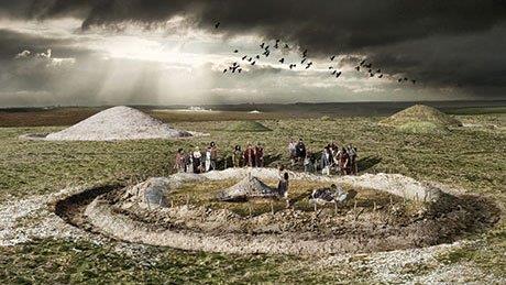
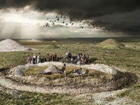
    Bronze Age

    What the largest barrow might have looked like

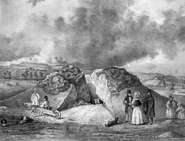
    Another large barrow closest to the Jubilee Stone had a circle of stones around it, 2 ft high, 6 ft wide at the base and 30 ft in diameter. A central mound of stones was 3 ft high and 14 ft in diameter, which joined the outer ring in 2 places. This is the barrow that in 1898 was excavated by Reverend George Masters from Flax Bourton, who described it like ‘a cup or basin inverted in its saucer’. He dug it in July, but probably not up to the usual rigorous standards adopted by today’s archaeologists.
    BA barrow

    How not to dig a barrow!

    Some antiquarians often dug out with picks and shovels the central area where they thought the burial and grave goods were, telling workmen to stop when they found bones or pottery. This is how Reverend John Skinner of Camerton managed to dig 100 barrows in 17 years, although, to his credit, he did make detailed sketches of them.
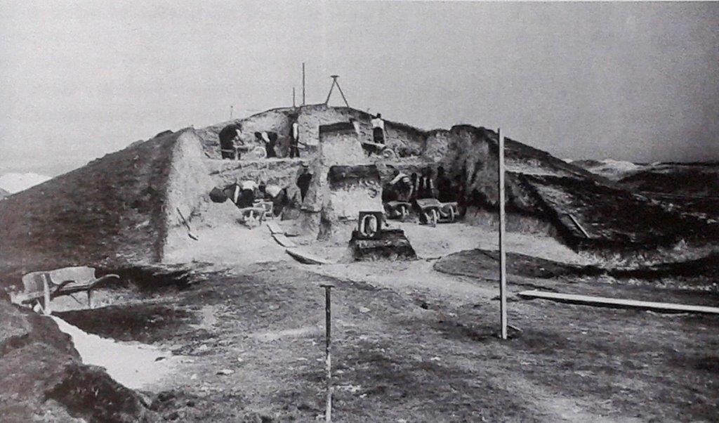
    Pitt Rivers barrow dig

    Pitt-Rivers excavating Wor Barrow, Dorset in 1893.

    General Augustus Lane-Fox Pitt-Rivers was very professional, and an important pioneer in many aspects of archaeology, his work being neat, methodical and accurately surveyed in accordance with his military training. Not only did he record all finds, however trivial, but also the contexts in which they were found, and published all the information in massive volumes, with copious illustrations that are informative even today.

    Back at Backwell, Reverend Masters was very disappointed by his barrow, because instead of burial urns and jewellery, etc. all he found was a pavement of flat stones, 2 ft down below the surface. They covered a layer of ‘moist and unctuous’ (greasy, soapy, oily) earth which yielded bones from pigs and smaller animals, but no human ones. There were also fragments of glazed earthenware, tobacco clay pipes and iron nails, all of a recent date, which he declared ‘constituted a puzzle’. As the nearby Jubilee Stone was only built the previous year in 1897, it is probable that these unexpected finds were left by the workmen, who buried traces of their meals and pipes beneath stones in the barrow – these stones being identical to those placed beneath the Stone itself.

    In 2011 both resistivity and magnetometry geophysics were carried out on several of the barrows to determine if any features still remained beneath the surface of the soil, and two previously unknown ones with ring ditches were found. Probably all the main burials are still intact, and although this could be confirmed by excavation, it is better that they remain intact and undisturbed, on the hillside where they have already lain for several thousand years.

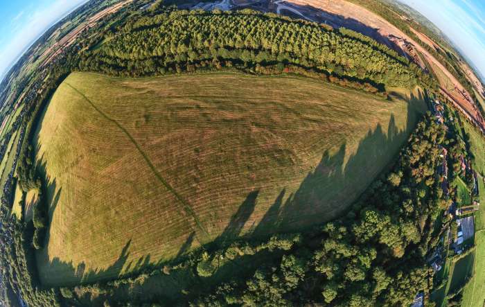
    Most of the top stones were removed to allow deep ploughing by tractors in the field after the War. Very little can be seen of the barrows today, apart from slightly raised surfaces in the grass.  This aerial photo, taken in the evening sun in September 2019 from 400 feet above the Jubilee Stone, clearly shows the circular outline of one of the barrows, to the left of centre.
    Barrow field HDR 700